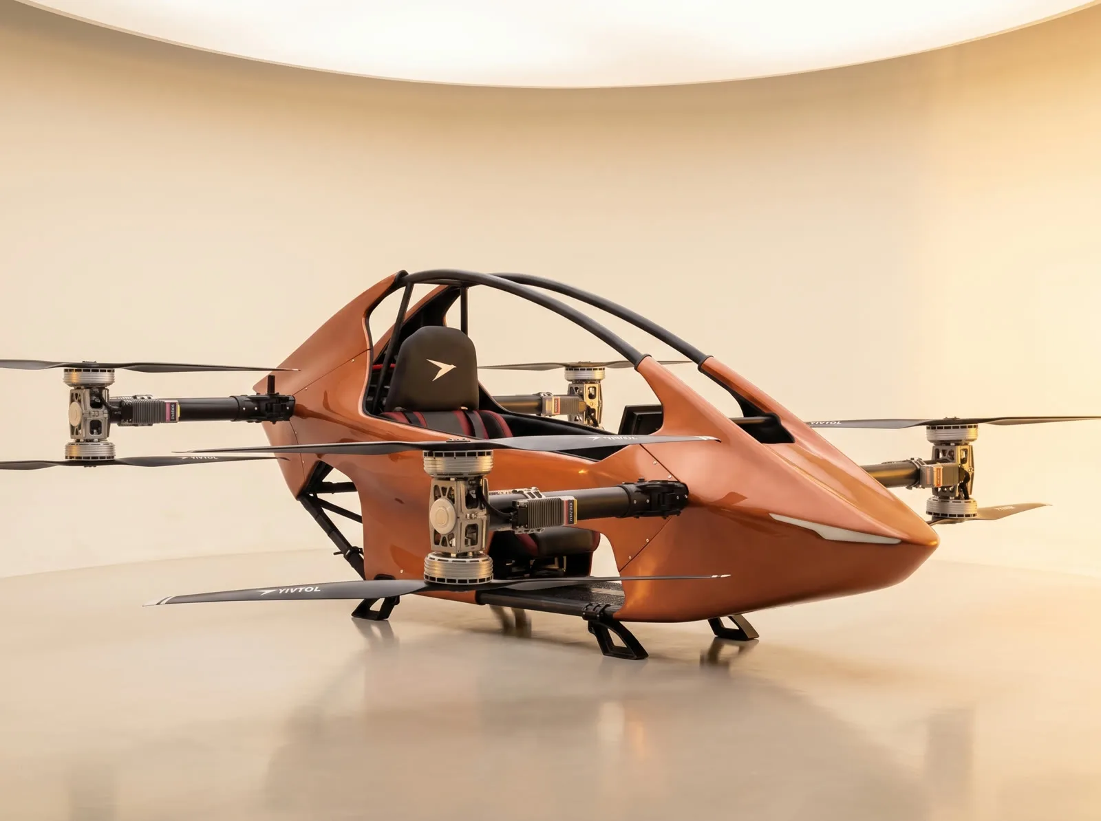
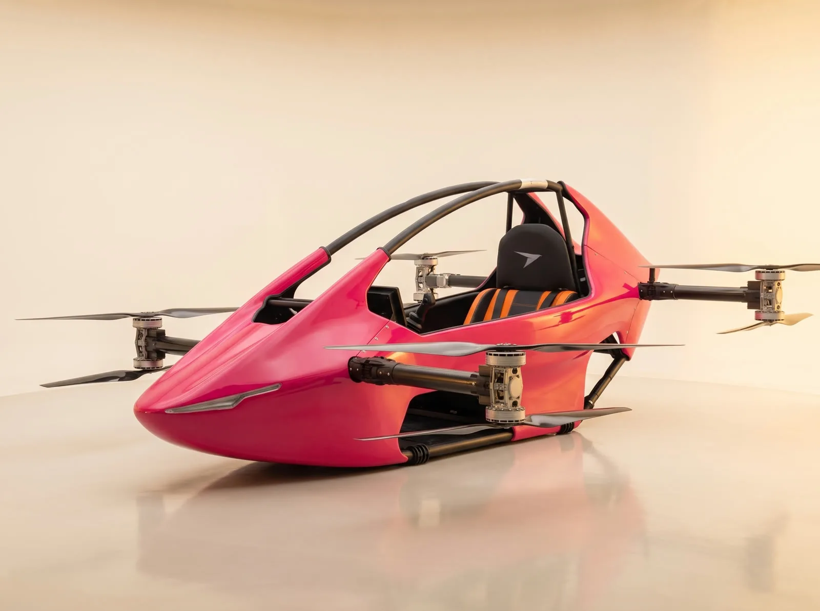
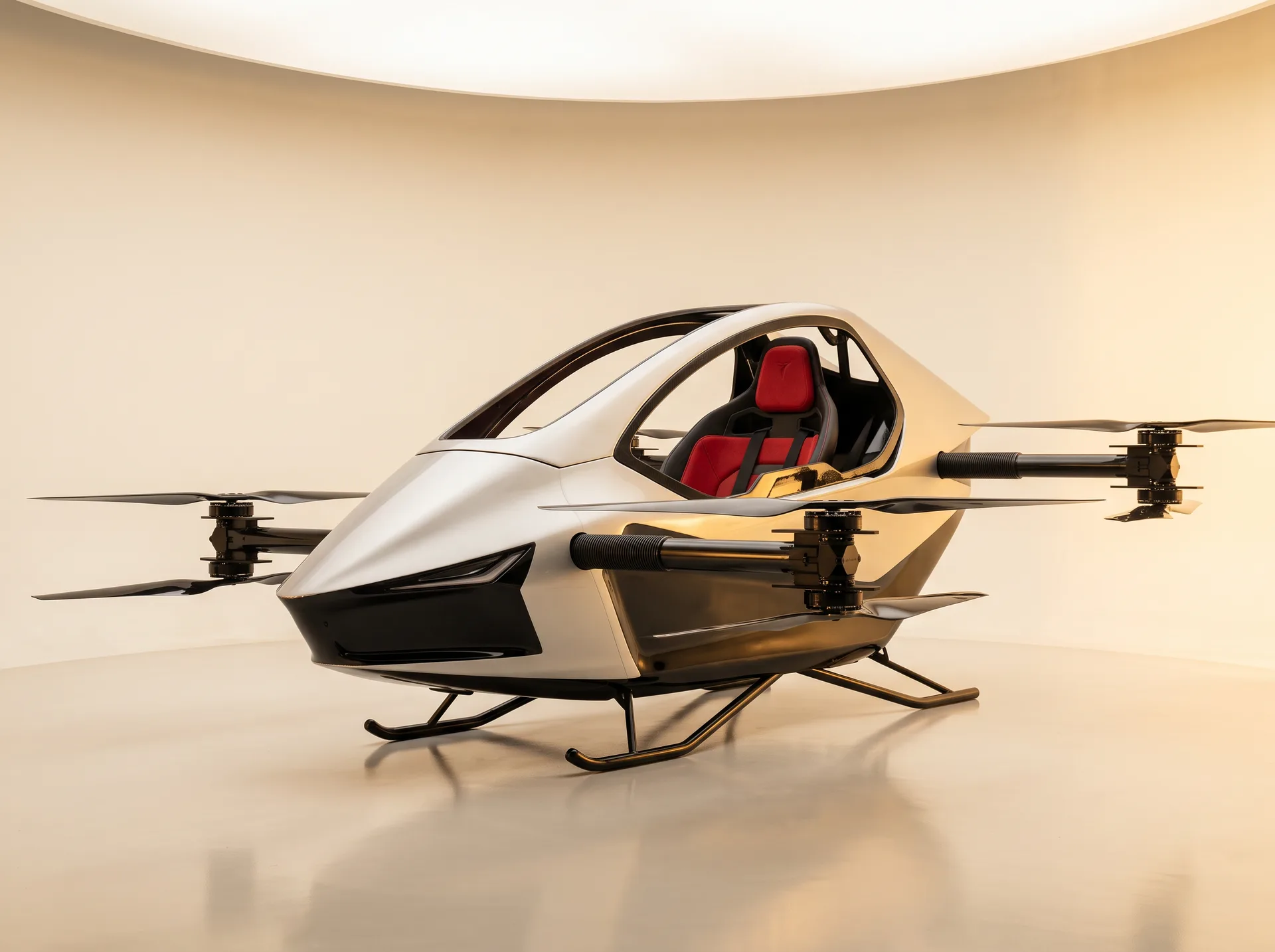
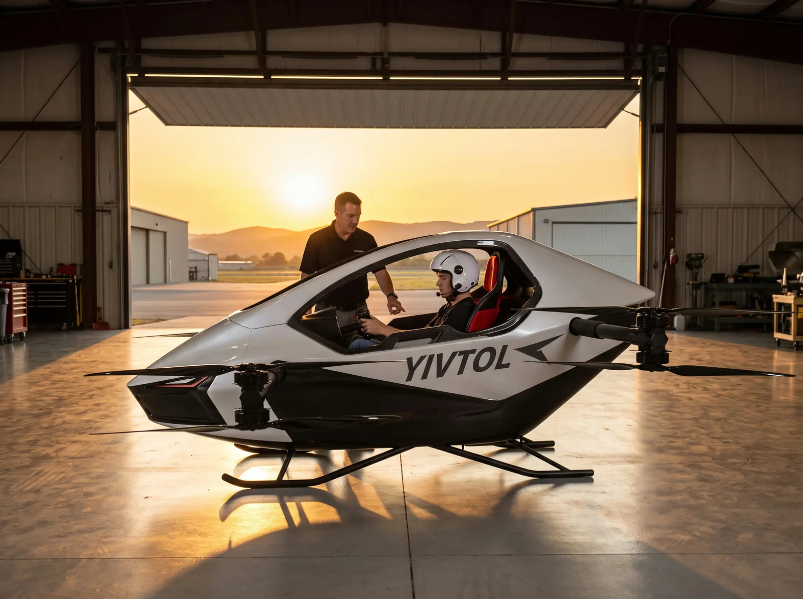
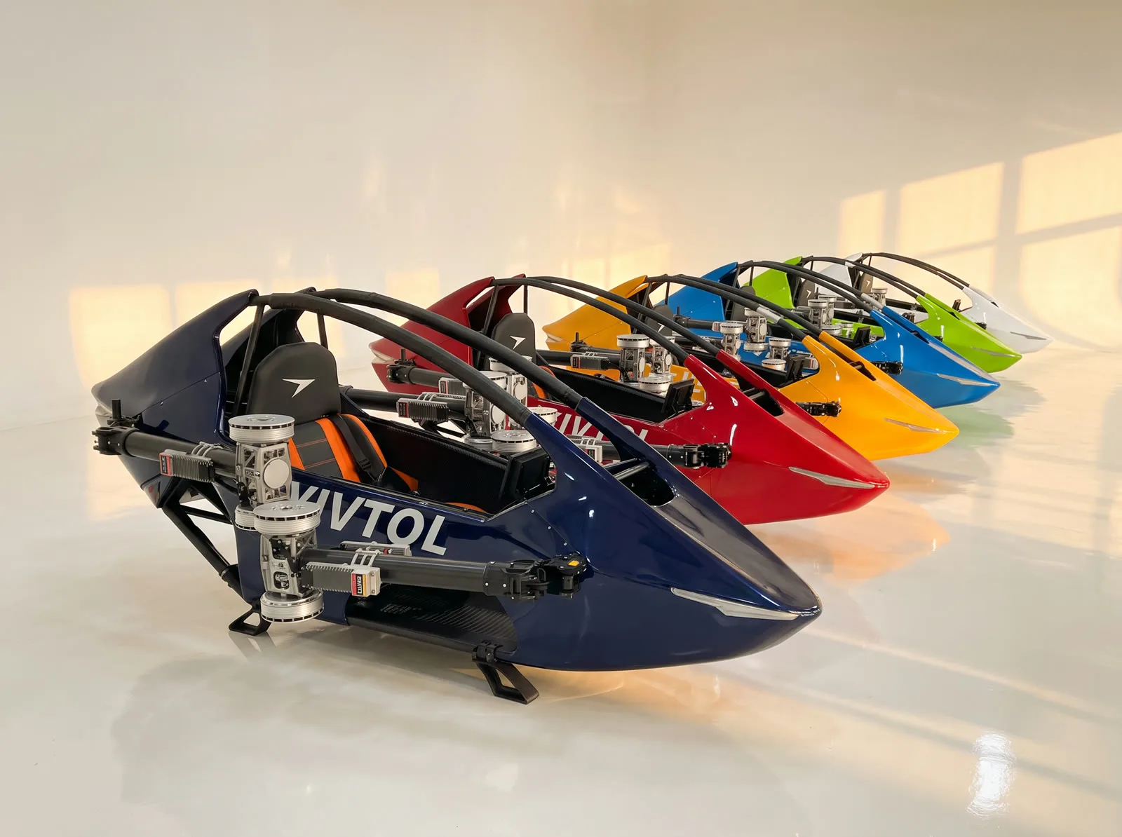
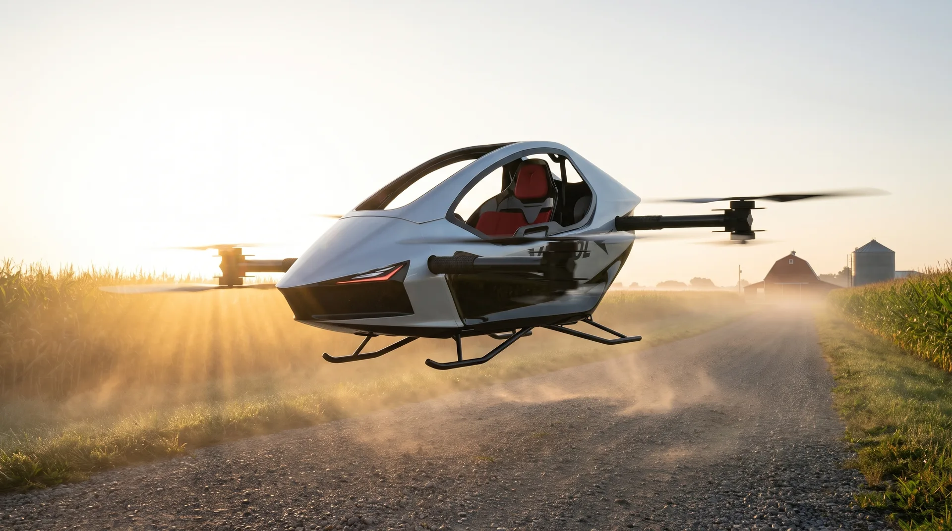
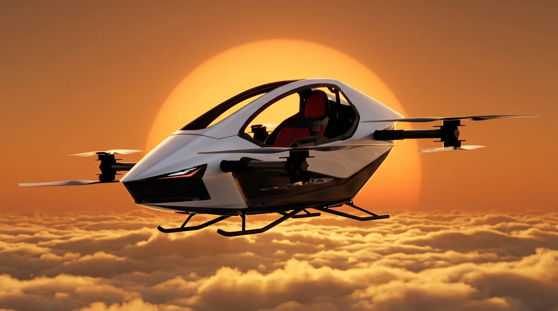
YIVTOL S-Zero Personal eVTOL Aircraft
YIVTOL S-Zero · FAA Part 103 ultralight · No pilot's license requiredLower 48 coverage: 48 states · Ottawa, IL Flight Desk (815-993-0363)

Used & factory-new personal eVTOLs for sale

Welcome to DroneSales.bid — an independent authorized Rise Vertical / YIVTOL reseller marketplace serving all 48 contiguous U.S. states. Shop factory-new YIVTOL S-Zero aircraft from $59,000 or Flight Desk-verified pre-owned and demo allocations from $44,900 with Instant Market Value (IMV) Deal Ratings, live bidding, and pilot training.

Safety-verified inventory: 8 coaxial motors · Titanium/carbon frame · Strict pilot weight limits (198 lb vs 264 lb) · Optional $20k ballistic parachute & airbag · Mandatory 6-point preflight.
Safety guide →
Explore 9 aircraft listings

Search personal eVTOLs

IMV verified
Est. delivery to Illinois:1–2 Days (Home Hub)
Show 9 matching aircraft
Authorized reseller

Official Rise Vertical & YIVTOL reseller across all 48 contiguous U.S. states

New & pre-owned

Factory-new allocations + Flight Desk-verified pre-owned inventory with IMV Deal Ratings

$19,900 import

Import, customs, tariffs, brokerage & doorstep crated air freight on new units across the Lower 48

Pilot training

Ottawa, IL Simulator Center & factory test pilot options — exact format confirmed by Flight Desk

Personal eVTOL marketplace

Every listing is rated against Instant Market Value (IMV) with serial and condition documentation verified through our Ottawa, IL Flight Desk (815-993-0363). Reserve at Buy-It-Now pricing or submit a binding bid on pre-owned & demo aircraft.

Sort:
2025 YIVTOL S-Zero Max — Low-Hour Consignment Allocation
Great dealPRE-OWNED · 8.0 HRS · MAX ENDURANCE
Price drop $4,500
Bozeman, MT
Stock #RV-2025-140Flight Desk-Verified Consignment Allocation

2025 YIVTOL S-Zero Max — Low-Hour Consignment Allocation

Buy-It-Now price
$124,500
$8,500 below IMV ($133,000)
Current bid (9)$119,000
Hours
8 hrs
Battery
99%
Endurance
40 min
Max pilot
264 lb
8 coaxial motors · $20k parachute option≥20% reserve · 6-pt check

Flight Desk-verified U.S. consignment allocation of the 40-minute S-Zero Max. Availability, serial verification, and battery cycle documentation are confirmed directly by the Ottawa, IL Flight Desk (815-993-0363).

Details
2026 YIVTOL S-Zero Plus — Certified Demo Allocation
Great dealDEMO ALLOCATION · 6.5 HRS
Price drop $2,500
Ottawa, IL
Stock #RV-2026-004Flight Desk-Verified Marketplace Allocation

2026 YIVTOL S-Zero Plus — Certified Demo Allocation

Buy-It-Now price
$72,500
$7,400 below IMV ($79,900)
Current bid (7)$68,500
Hours
6.5 hrs
Battery
99%
Endurance
25 min
Max pilot
264 lb
8 coaxial motors · $20k parachute option≥20% reserve · 6-pt check

Flight Desk-verified demonstration allocation bundled with $13,000 in factory accessories. Current flight-hour log, battery cycle summary, and pre-delivery checklist are provided directly by the Ottawa, IL Flight Desk (815-993-0363) prior to bid acceptance.

Details
2026 YIVTOL S-Zero — Factory Direct New
Great dealNEW · FACTORY DIRECT
Ottawa, IL
Stock #RV-2026-NEW01Authorized Factory Reseller

2026 YIVTOL S-Zero — Factory Direct New

Factory-direct base
$59,000
$5,500 below IMV ($64,500)
All-in delivered$78,900
Hours
0.5 hrs
Battery
100%
Endurance
15 min
Max pilot
198 lb
8 coaxial motors · $20k parachute option≥20% reserve · 6-pt check

Brand-new factory allocation through our authorized Rise Vertical / YIVTOL reseller desk. Eligible for crated Lower-48 delivery and Flight Desk-scheduled pilot training.

Details
2025 YIVTOL S-Zero — Pre-Owned Ranch Allocation
Great dealPRE-OWNED · 18.2 HRS · OPEN FOR BIDS
Price drop $3,100
Austin, TX
Stock #RV-2025-089Flight Desk-Verified Trade-In Allocation

2025 YIVTOL S-Zero — Pre-Owned Ranch Allocation

Buy-It-Now price
$49,900
$5,900 below IMV ($55,800)
Current bid (11)$46,500
Hours
18.2 hrs
Battery
96%
Endurance
15 min
Max pilot
198 lb
8 coaxial motors · $20k parachute option≥20% reserve · 6-pt check

Flight Desk-verified trade-in marketplace allocation toward an S-Zero Max. Serial documentation, battery cycle readout, and physical inspection records are confirmed directly by the Ottawa, IL Flight Desk (815-993-0363) before closing.

Details
2026 YIVTOL S-Zero Max — Flagship 40-Min Endurance
Great dealNEW · 40-MIN ENDURANCE
Ottawa, IL
Stock #RV-2026-NEW04Authorized Factory Reseller

2026 YIVTOL S-Zero Max — Flagship 40-Min Endurance

Factory-direct base
$139,000
$6,000 below IMV ($145,000)
All-in delivered$158,900
Hours
0.8 hrs
Battery
100%
Endurance
40 min
Max pilot
264 lb
8 coaxial motors · $20k parachute option≥20% reserve · 6-pt check

Top-of-the-line S-Zero Max factory allocation with 40-minute flight endurance and 264 lb pilot capacity. Ottawa simulator and on-site training options coordinated by the Flight Desk.

Details
2025 YIVTOL S-Zero — Pre-Owned Entry Allocation
Great dealPRE-OWNED · 31.5 HRS · OPEN FOR BIDS
Price drop $3,000
Asheville, NC
Stock #RV-2025-064Flight Desk-Verified Marketplace Allocation

2025 YIVTOL S-Zero — Pre-Owned Entry Allocation

Buy-It-Now price
$44,900
$4,600 below IMV ($49,500)
Current bid (14)$42,000
Hours
31.5 hrs
Battery
93%
Endurance
15 min
Max pilot
198 lb
8 coaxial motors · $20k parachute option≥20% reserve · 6-pt check

Flight Desk-verified pre-owned entry allocation into personal eVTOL flight. Current maintenance records, rotor inspection status, and battery health report are confirmed directly by the Ottawa, IL Flight Desk (815-993-0363) prior to purchase or bid closing.

Details
2026 YIVTOL S-Zero Plus — Factory Direct Allocation
Good dealNEW · FACTORY DIRECT
Ottawa, IL
Stock #RV-2026-NEW02Authorized Factory Reseller

2026 YIVTOL S-Zero Plus — Factory Direct Allocation

Factory-direct base
$79,000
$4,000 below IMV ($83,000)
All-in delivered$98,900
Hours
0.4 hrs
Battery
100%
Endurance
25 min
Max pilot
264 lb
8 coaxial motors · $20k parachute option≥20% reserve · 6-pt check

Our #1 selling personal eVTOL model. Combines 264 lb pilot capacity with 25-minute endurance and 2-minute quick-swap battery architecture.

Details
2025 YIVTOL S-Zero Plus — Dual-Battery & Parachute Allocation
Good dealPRE-OWNED · 11.4 HRS · PARACHUTE EQUIPPED
Price drop $1,900
Scottsdale, AZ
Stock #RV-2025-112Flight Desk-Verified Partner Allocation

2025 YIVTOL S-Zero Plus — Dual-Battery & Parachute Allocation

Buy-It-Now price
$76,900
$5,600 below IMV ($82,500)
Current bid (5)$73,000
Hours
11.4 hrs
Battery
98%
Endurance
25 min
Max pilot
264 lb
8 coaxial motors · Ballistic parachute included≥20% reserve · 6-pt check

Flight Desk-verified marketplace allocation configured with ballistic parachute & airbag system plus dual quick-swap batteries. Complete accessory manifest and condition verification handled through the Ottawa, IL Flight Desk (815-993-0363).

Details
2026 YIVTOL S-Zero Lite — Aero Carbon Edition
Good dealNEW · PRIORITY BUILD SLOT
Ottawa, IL
Stock #RV-2026-NEW03Authorized Factory Reseller

2026 YIVTOL S-Zero Lite — Aero Carbon Edition

Factory-direct base
$99,000
$3,000 below IMV ($102,000)
All-in delivered$118,900
Hours
0 hrs
Battery
100%
Endurance
25 min
Max pilot
264 lb
8 coaxial motors · $20k parachute option≥20% reserve · 6-pt check

Sculpted aerodynamic carbon body with reduced drag profile and signature gold-weave cockpit trim.

Details

Marketplace safety & preflight verification standard

Safety on every flight: coaxial redundancy, preflight discipline, and Part 103 limits

Every YIVTOL S-Zero allocation on DroneSales.bid is matched to your pilot weight envelope, backed by 8-motor coaxial propulsion and AI attitude stabilization, and paired with a 6-point preflight checklist and Class G airspace rules.

8 coaxial motors + titanium & carbon frame

Eight brushless electric motors mounted on four coaxial booms pair with an extra-high-strength titanium tube and carbon-fiber cockpit structure built within the 253 lb FAA Part 103 airframe limit.

AI-stabilized joystick & 60 mph governor

Redundant onboard flight computers stabilize pitch, roll, and altitude while software-limiting top level speed to ~60 mph inside 14 CFR Part 103 limits.

Optional ballistic parachute & cockpit airbag

Available as a $20,000 factory safety option on new builds — and pre-installed on select pre-owned allocations — for whole-airframe emergency descent protection.

Strict pilot weight matching & simulator prep

We enforce strict pilot weight limits (198 lb max on base S-Zero; 264 lb max on Plus, Lite, and Max) and coordinate Ottawa, IL simulator and test-pilot training before solo flight.

Mandatory 6-point preflight checklist

14 CFR Part 103 · Daylight VFR · Single occupant · Zero congested areas
  1. 1. Boom pins lockedConfirm all four folding carbon rotor booms are seated and locking pins are fully engaged.
  2. 2. Eight coaxial props undamagedInspect all eight upper and lower carbon-fiber blades for nicks, cracks, or fastener play.
  3. 3. Parachute pin briefedOn ballistic parachute and airbag-equipped units, verify safety pin status and cockpit handle path.
  4. 4. 20% minimum landing battery reserveConfirm cell balance and plan flight duration so you touch down with at least 20% charge remaining.
  5. 5. Winds and density altitude checkedVerify calm daylight VFR conditions, gust spread, and local temperature/elevation thrust margin.
  6. 6. Class G airspace verified in B4UFLYCheck Airspace Link AirHub or Aloft for uncontrolled Class G airspace, zero active TFRs, and clear departure paths.

Post-Incident & Hard-Landing Rule: Never fly an aircraft after any hard landing, prop strike, or fault alert. Ground the unit immediately and contact our Flight Desk (if anyone is injured, call 911 first).

Flight Safety Desk: 815-993-0363

2026 YIVTOL S-Zero factory lineup

Order factory-new through our Rise Vertical partnership with guaranteed lowest USA pricing, or compare against our pre-owned marketplace above.

YIVTOL S-Zero
Entry edition

YIVTOL S-Zero

15-minute endurance for pilots up to 198 lb.

Base aircraft$59,000
With $19.9k import$78,900
Avg flight
15 min · quick-swap
Pilot (normal)
80 kg / 176 lb
Pilot (max)
90 kg / 198 lb
Airframe
Titanium & carbon
Control
AI-stabilized joystick
YIVTOL S-Zero Plus
264 lb payload

YIVTOL S-Zero Plus

25-minute endurance and 264 lb max pilot capacity.

Base aircraft$79,000
With $19.9k import$98,900
Avg flight
25 min · quick-swap
Pilot (normal)
105 kg / 231 lb
Pilot (max)
120 kg / 264 lb
Airframe
Titanium & carbon
Control
AI-stabilized joystick
YIVTOL S-Zero Lite
Aero carbon

YIVTOL S-Zero Lite

Streamlined carbon-fiber cockpit fairing with 25-minute endurance.

Base aircraft$99,000
With $19.9k import$118,900
Avg flight
25 min · quick-swap
Pilot (normal)
105 kg / 231 lb
Pilot (max)
120 kg / 264 lb
Airframe
Titanium & carbon
Control
AI-stabilized joystick
YIVTOL S-Zero Max
40-min endurance

YIVTOL S-Zero Max

40-minute flight endurance per charge for extended property coverage.

Base aircraft$139,000
With $19.9k import$158,900
Avg flight
40 min · quick-swap
Pilot (normal)
105 kg / 231 lb
Pilot (max)
120 kg / 264 lb
Airframe
Titanium & carbon
Control
AI-stabilized joystick

Match your pilot weight & mission

Adjust your pilot weight and primary mission below to match the right YIVTOL S-Zero configuration across both new and pre-owned inventory.

120 lb198 lb (base limit)264 lb max
Recommended configuration
YIVTOL S-Zero Plus

25-minute endurance and 264 lb max pilot capacity.

Factory-new base:$79,000

Vertical takeoff without a runway, hangar, or pilot license

Personal flight used to require an airstrip, a hangar lease, and a drive to a municipal airport. The YIVTOL S-Zero rises vertically off open private land, flies by joystick with AI-assisted attitude stabilization, and folds into the bed of a pickup truck.

YIVTOL S-Zero Lineup

Titanium airframe, carbon body

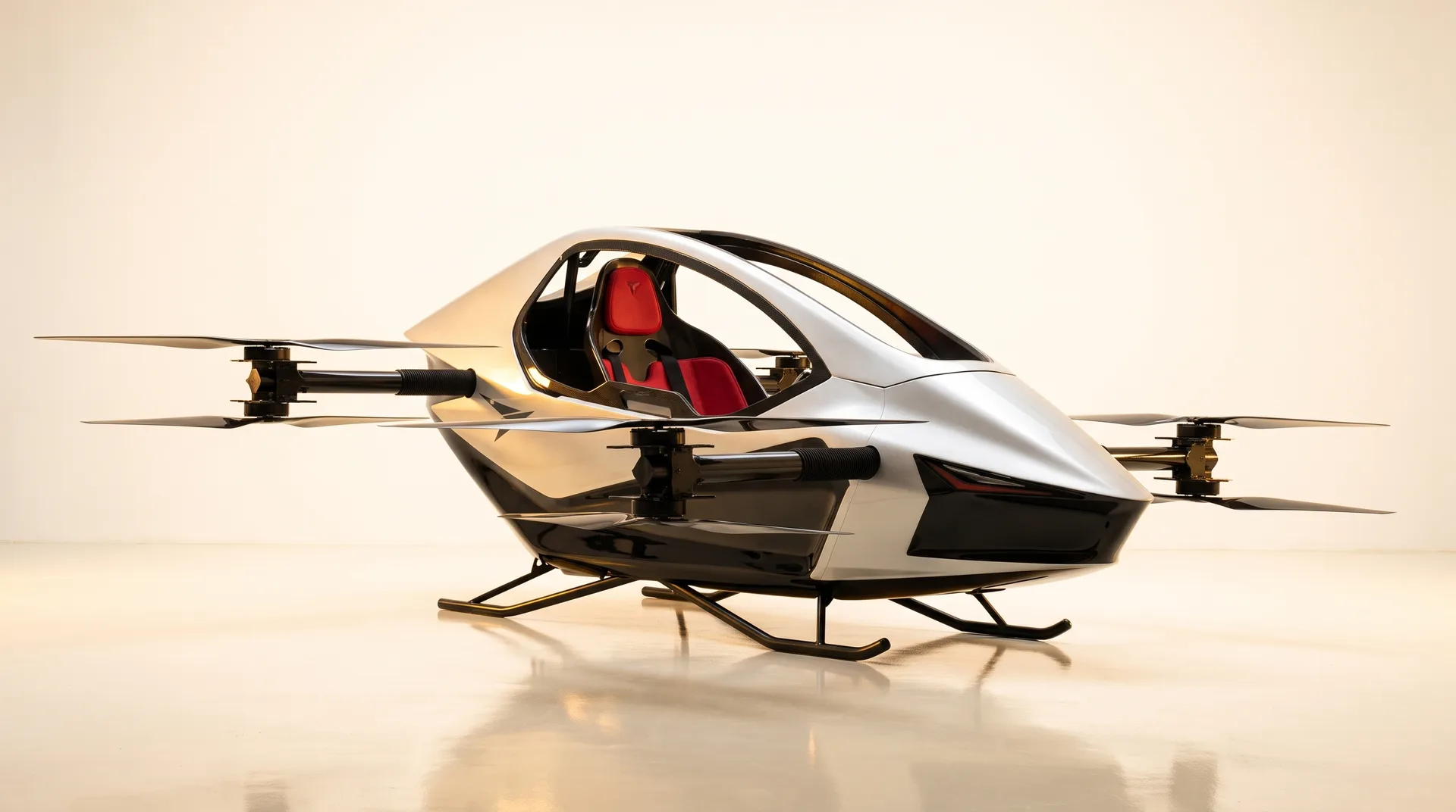
An extra-high-strength titanium tube airframe wrapped in carbon-fiber panels keeps empty airframe weight at 115 kg (253 lb) under FAA Part 103.

AI-assisted flight control

Redundant flight computers stabilize pitch, roll, and altitude continuously while enforcing attitude envelope limits.

Multi-axis cockpit joystick

Single primary flight control for climb, direction, and speed, paired with simulator and instructor orientation.

2-minute quick-swap batteries

High-discharge lithium-ion packs swap in roughly two minutes on the ground between sorties.

8-motor coaxial electric propulsion

Eight brushless motors across four coaxial rotor booms, electronically governed to 60 mph (FAA Part 103 caps level speed at 55 knots / ~63 mph).

Folds for pickup bed or van transport

Motor booms fold inward so the aircraft loads into a standard pickup bed, trailer, or residential garage bay.

The $19,900 import, delivery & onboarding package

Importing a new aircraft normally means freight forwarders, customs brokers, tariff schedules, and paperwork. Through our Rise Vertical distribution partnership, your new S-Zero arrives crated at your doorstep anywhere in the Lower 48 states for one flat package price of $19,900. Factory delivery is ~1 month per YIVTOL and Rise Vertical targets ~45 days purchase-to-flying (estimates only — no delivery guarantees; Flight Desk at 815-993-0363 confirms exact training structure and timeline).

  • Global air freight & crated doorstep delivery across all 48 contiguous states
  • U.S. Customs clearance, brokerage fees & import tariffs handled end-to-end
  • Simulator & test-pilot training options coordinated & confirmed by our Ottawa, IL Flight Desk (815-993-0363)
  • Buying Used / Certified Demo on DroneSales.bid? Skip the $19,900 import package — ships domestically in 1–6 days.
Doorstep Crated Aircraft Delivery
Step 1 · Doorstep delivery

Crated delivery to your property

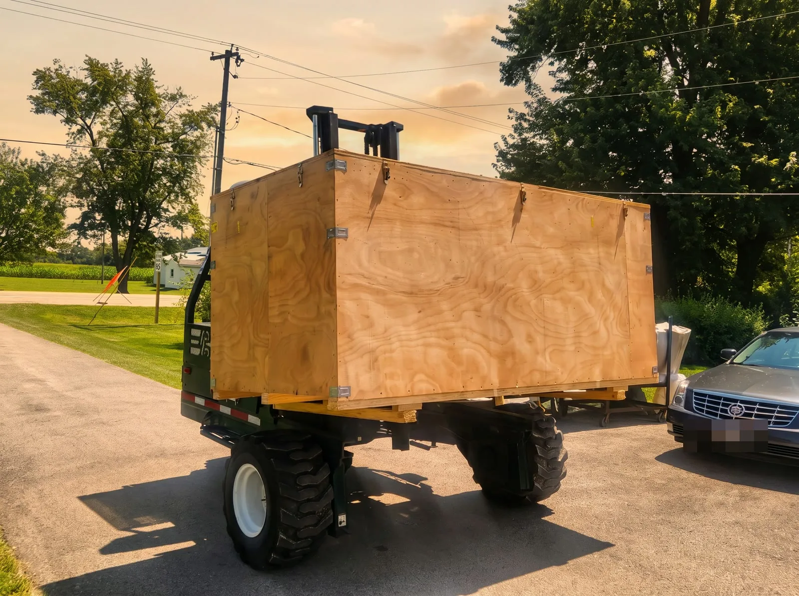
Your S-Zero arrives crated at your home or ranch with guidance for uncrating, rotor boom lock-in, and preflight telemetry checks.

Factory Test Pilot Home Training
Step 2 · Simulator & pilot orientation

Ottawa, IL simulator & instructor options

Train in our Ottawa, IL S-Zero Flight Simulator Center and coordinate instructor-led flight orientation through our Flight Desk.

FAA Part 103 & ownership answers

Qualifying FAA Part 103 ultralight flight operates under specific weight, speed, daylight, and Class G airspace rules that differ from certificated general aviation.

Lowest USA price guarantee

Found a lower written price from an authorized U.S. seller on any new or certified S-Zero model or accessory? Send it to our desk and we will beat it.

Send a price to beat
6 FAA Part 103 & ownership questions

No. Qualifying FAA Part 103 ultralight vehicles do not require a pilot license, medical certificate, or FAA registration to be flown in the United States. Training options (Ottawa, IL Flight Simulator Center and backyard test-pilot instruction) are scheduled through our Flight Desk.

New factory units add a $19,900 import, delivery, and training package (factory delivery is roughly 1 month after order per YIVTOL, targeting purchase-to-flying within ~45 days; Flight Desk confirms exact training scope and schedule, with no delivery guarantees). Used and Demo units already in the U.S. skip that $19,900 package, ship domestically in 1 to 6 days across the Lower 48, and are open for bids.

Our Instant Market Value (IMV) comparison weighs each aircraft asking price against factory MSRP, already-paid $19,900 import/tariff value, installed factory accessories (such as extra $10,000 battery sets or $20,000 parachute systems), flight hours, and battery cycle health.

Yes. Any pre-owned or demo listing marked open for bids lets you reserve at the Buy-It-Now price or submit a verified bid through our Ottawa, IL Flight Desk.

No. Under FAA Part 103 rules, qualifying ultralight aircraft do not require FAA registration or any FAA medical certificate.

Part 103 allows flight during daylight hours (and twilight with an operating anti-collision strobe visible for 3 statute miles) in uncontrolled airspace (Class G) away from congested areas and open-air assemblies. Ranches, farms, lakefront acreage, and rural properties across the Lower 48 fit within these rules.

Official FAA B4UFLY & LAANC instructional reference

Know your airspace: B4UFLY & Airspace Link guide

Complete pilot reference and embedded YouTube video training for checking controlled airspace, Temporary Flight Restrictions (TFRs), Military Training Routes, and LAANC authorizations across the Lower 48 states using Airspace Link (AirHub Portal) and all six FAA-approved desktop & mobile B4UFLY applications listed on faa.gov/uas/getting_started/b4ufly.

Interactive Google Maps + B4UFLY flight plan builder

Build a safe flight plan and navigate airspace

Select a real Lower-48 flying corridor below, inspect live Google Maps satellite terrain alongside B4UFLY / Airspace Link airspace boundaries, plot custom waypoints around controlled airspace and congested areas, verify FAA Part 103 & LAANC compliance, and run a live mission simulation.

KVYS (Illinois Valley Regional) — 4.2 NM West
14 CFR Part 103 · No license required
3. Cruise altitude180 ft AGL (max 400)
50 ft200 ft400 ft cap
Wind: 7 kt · Vis: 10 SM
B4UFLY status: Clear to fly · Class G uncontrolled
GPS: 41.3912° N, 88.8415° WAlt: 180 ft AGLHdg: 75°Route: 7 mi (12 min)Reserve: 70% bat
Google Maps satellite terrain · Ottawa, IL (Class G Clear)
41.3856° N, 88.8364° W
Airspace: Class G Uncontrolled (Surface to 700 ft AGL)UASFM ceiling: 400 ft AGL
Interactive airspace & waypoint plotter (click map to add waypoint)
5 waypoints
Controlled AirspaceLAANC grid: 400 ftCongested Area14 CFR § 103.15 avoidTFR / RestrictedNo-fly bufferClass G · 400 ftUncontrolled corridorWP1WP2WP3WP4WP5
Active leg (WP1):Takeoff Pad (Rise Vertical HQ)
Progress: 0%
Turn-by-turn flight plan waypoints

1. Ottawa, IL Flagship Flight Center (Illinois River Corridor)

7 mi · 12 min
WP1
Takeoff Pad (Rise Vertical HQ)(41.3912° N, 88.8415° W · 0 ft AGL)

Pre-flight B4UFLY pin verified Clear (Class G). Battery 100% SOH.

WP2
North Prairie Climb Gate(41.3965° N, 88.8280° W · 180 ft AGL)

Climb to 180 ft AGL cruise altitude over open agricultural acreage.

WP3
Fox River Scenic Turn (Avoids Town)(41.3880° N, 88.8110° W · 180 ft AGL)

28° starboard turn maintaining 1.2 NM clearance from Ottawa congested area (§ 103.15).

WP4
East Acreage Downwind Leg(41.3740° N, 88.8190° W · 180 ft AGL)

Remains north of State Park boundary and outside KVYS traffic pattern.

WP5
Landing Pad (Rise Vertical HQ)(41.3908° N, 88.8410° W · 0 ft AGL)

Vertical descent and touchdown on private turf pad. 67% battery reserve remaining.

Automated safety & regulatory validator

FAA & B4UFLY guideline checks

Clear for takeoff
Class G uncontrolled airspace / lateral boundary clearance14 CFR § 103.17 Airspace

Flight path stays at 180 ft AGL inside authorized Class G / LAANC ceiling (400 ft max).

Temporary Flight Restrictions (TFR) & prohibited area avoidance14 CFR § 103.19 / NOTAMs

Screened via B4UFLY & Airspace Link — route clears Starved Rock State Park No-Landing Buffer (South).

No flight over congested areas or open-air assemblies14 CFR § 103.15

Waypoints route around Downtown Ottawa Congested Settlement (14 CFR § 103.15) over open terrain.

Daylight / civil twilight anti-collision strobe & 3-SM visibility14 CFR § 103.11 / Visibility

Daylight operation (Sunrise–Sunset) with 10 SM visibility.

≥ 20% Li-Ion battery reserve at touchdownEnergy Reserve SOP

Mission requires 12 min (7 mi), leaving 70% battery reserve.

Instructional view filter (default: showing all legal & flight instructions)
U.S. Federal Aviation compliance · 14 CFR Part 103 · 49 U.S.C. § 44809 · 14 CFR Part 107

How to fly legally in the United States — step-by-step instructions

Follow all seven mandatory legal steps below before every flight. This section contains the statutory requirements for Manned FAA Part 103 Ultralight eVTOLs (such as the YIVTOL S-Zero series), Unmanned Recreational Drones (49 U.S.C. § 44809), and Commercial Remote Pilots (14 CFR Part 107).

1
Step 1

Identify which Federal Aviation rulebook governs your aircraft

14 CFR § 103.1 / 49 U.S.C. § 44809 / 14 CFR Part 107
  • Manned Personal eVTOL / Ultralight (YIVTOL S-Zero Series): Governed by 14 CFR Part 103 if flown by a single occupant strictly for recreation or sport, with no U.S. or foreign airworthiness certificate, empty weight under 254 lbs (115 kg) excluding floats and emergency safety devices (ballistic parachute & airbag system), max level speed ≤ 55 knots (63 mph), and power-off stall speed ≤ 24 knots (28 mph).
  • Unmanned Recreational Drone (Under 55 lbs): Governed by 49 U.S.C. § 44809 (The Exception for Limited Recreational Operations of Unmanned Aircraft) when flown strictly for personal hobby/recreation.
  • Unmanned Commercial / Non-Recreational Drone (Under 55 lbs): Governed by 14 CFR Part 107 (Small Unmanned Aircraft Systems) whenever flown for business, compensation, real estate, agriculture, inspection, or any non-recreational purpose.
2
Step 2

Complete all required pilot certifications, registration & Remote ID before takeoff

14 CFR § 103.7 / 14 CFR Part 89 / 14 CFR § 107.61
  • For Manned FAA Part 103 Ultralight Flight: Under 14 CFR § 103.7, no pilot license, no medical certificate, no airworthiness certificate, and no FAA aircraft registration or N-number markings are required. Complete your factory test-pilot orientation and simulator checkout before solo flight.
  • For Unmanned Recreational Flyers (49 U.S.C. § 44809): (1) Pass the free online TRUST (The Recreational UAS Safety Test) exam and carry your digital/printed certificate; (2) Register any drone weighing > 0.55 lbs (250g) at faadronezone.faa.gov ($5 for 3 years) and mark the exterior with your registration number; (3) Comply with Standard Remote ID (14 CFR Part 89).
  • For Commercial Part 107 Remote Pilots: (1) Hold a current FAA Part 107 Remote Pilot Certificate (pass the initial UAG knowledge exam at an FAA testing center and complete online recurrent training ALC-677 every 24 months); (2) Register each aircraft individually ($5 per aircraft) on FAA DroneZone; (3) Broadcast Standard Remote ID.
3
Step 3

Verify ground takeoff & landing permission (federal vs. state & property law)

49 U.S.C. § 40103 / 36 CFR § 1.5 / Local Land-Use Law
  • Understand Federal Airspace Preemption vs. Ground Property Rights: The FAA exercises exclusive sovereignty over navigable airspace (49 U.S.C. § 40103), but state/local governments and property owners regulate where aircraft may physically take off and land on the ground.
  • Private Property & Ranches: Always launch and land on your own private property or obtain explicit permission from the landowner before operating from private acreage, farms, or estates.
  • Federal & State Public Lands: Never launch, land, or operate inside U.S. National Parks (prohibited under NPS Policy Memorandum 14-05 / 36 CFR § 1.5) or designated Federal Wilderness Areas (16 U.S.C. § 1133(c)) without a special federal permit. Check local municipal and state park rules before taking off from public parks.
4
Step 4

Screen airspace, TFRs, stadiums & prohibited zones in an official B4UFLY app

14 CFR § 103.19 / § 103.20 / § 91.137–91.145 / § 99.7
  • Open an FAA-Approved B4UFLY Application: Launch Airspace Link (AirHub Portal), Aloft (Air Aware), AutoPylot, Avision, FlightLoop, or UASidekick on your desktop browser, iPhone/iPad, or Android device and drop a pin on your exact takeoff coordinates.
  • Check Temporary Flight Restrictions (TFRs) & NOTAMs (14 CFR § 103.20): Verify zero active or scheduled TFRs for Presidential/VIP movements (§ 91.141), wildfire/disaster emergency response (§ 91.137), space launches (§ 91.143), or major airshows (§ 91.145).
  • Respect Stadium Sporting Event Restrictions (14 CFR § 99.7 / FDC NOTAM): Flight is prohibited within a 3-nautical-mile radius up to 3,000 ft AGL of any stadium with a seating capacity of 30,000+ people hosting an MLB, NFL, NCAA Division I football, or NASCAR/IndyCar event from 1 hour before scheduled start until 1 hour after the event ends.
  • Avoid Prohibited & Restricted Areas (14 CFR § 103.19): Never enter Prohibited Areas (such as P-56 / Washington, D.C. Special Flight Rules Area & Flight Restricted Zone) or active military Restricted Areas without controlling agency permission.
5
Step 5

Confirm Class G uncontrolled airspace or obtain prior ATC / LAANC authorization

14 CFR § 103.17 / 49 U.S.C. § 44809(a)(5) / 14 CFR § 107.41
  • Flying in Class G (Uncontrolled) Airspace: If B4UFLY / Airspace Link confirms your location is in Class G uncontrolled airspace (typically surface to 700 ft or 1,200 ft AGL away from airports), no Air Traffic Control (ATC) permission or LAANC filing is required.
  • Manned Part 103 Ultralight in Controlled Airspace (14 CFR § 103.17): No person may operate an ultralight vehicle within Class A, Class B, Class C, or Class D airspace or within the lateral boundaries of the surface area of Class E airspace designated for an airport unless that person has prior authorization from the ATC facility having jurisdiction over that airspace.
  • Unmanned Drones in Controlled Airspace (LAANC): Recreational and Part 107 drone pilots operating in Class B, C, D, or Surface Class E airspace must submit an automated LAANC request via one of the 6 FAA-approved LAANC suppliers at or below the UAS Facility Map (UASFM) ceiling (0–400 ft) and receive FAA authorization before takeoff.
6
Step 6

Enforce daylight / civil twilight strobe, surface visibility, cloud clearance & right-of-way rules

14 CFR § 103.11 / § 103.13 / § 103.21 / § 103.23
  • Daylight & Civil Twilight Rule (14 CFR § 103.11): Operate manned Part 103 ultralights only between sunrise and sunset. Flight during civil twilight (30 minutes before official sunrise and 30 minutes after official sunset) is legal only in uncontrolled (Class G) airspace when equipped with an operating anti-collision strobe visible for at least 3 statute miles. Night flight after civil twilight is prohibited for Part 103 ultralights.
  • Visual Reference with the Surface & Weather Minimums (§ 103.21 & § 103.23): Maintain continuous visual reference with the ground. In Class G airspace at or below 1,200 ft AGL, maintain at least 1 statute mile flight visibility and stay clear of clouds (we recommend ≥ 3 SM visibility and ≤ 15 mph surface winds).
  • See-and-Avoid & Right-of-Way (14 CFR § 103.13): Maintain constant visual vigilance to see and avoid other aircraft. Ultralight vehicles and unmanned drones must always yield the right-of-way to all manned airplanes, helicopters, and gliders.
7
Step 7

Never fly over congested areas, open-air crowds, or create a hazard

14 CFR § 103.9 / § 103.15 / 14 CFR § 107.23 / § 107.39
  • No Congested Areas or Open-Air Assemblies (14 CFR § 103.15): Never operate a Part 103 ultralight over any congested area of a city, town, or settlement (dense residential subdivisions, downtown cores, commercial shopping districts, or busy highways), or over any open-air assembly of persons (concerts, festivals, sporting events, beaches, or parades).
  • Route Around Settlements Using Google Maps & B4UFLY: Plot your takeoff, cruise, and landing legs over open agricultural fields, ranches, waterways, or uncongested rural corridors with safe forced-landing areas below at all times.
  • No Hazardous Operations or Dropped Objects (14 CFR § 103.9): Never operate in a careless or reckless manner that endangers the life or property of another, and never allow any object to be dropped if it creates a hazard to persons or property.
Federal statutory table · Title 14 Code of Federal Regulations Part 103

All 13 sections of FAA 14 CFR Part 103 (Ultralight Vehicles) explained

14 CFR §§ 103.1 – 103.23
14 CFR § 103.1Mandatory vehicle qualification

Applicability (5-Point Ultralight Vehicle Definition)

Defines an ultralight vehicle as an aircraft that: (a) is used or intended for manned operation by a single occupant; (b) is used or intended for recreation or sport purposes only; (c) does not have any U.S. or foreign airworthiness certificate; (d) if powered, weighs less than 254 lbs (115 kg) empty weight, excluding floats and safety devices intended for deployment in a potentially catastrophic situation (ballistic parachute & airbags); has fuel capacity ≤ 5 U.S. gallons (or electric battery energy storage); has max level flight speed ≤ 55 knots CAS (63 mph); and has power-off stall speed ≤ 24 knots CAS (28 mph).

14 CFR § 103.3Allow FAA inspection on request

Inspection Requirements

Any person operating an ultralight vehicle under Part 103 must, upon request, allow the FAA Administrator or designee to inspect the vehicle to determine whether it is in compliance with Part 103 weight and performance limits.

14 CFR § 103.5Written FAA waiver for deviations

Waivers

No person may conduct operations that require a deviation from Part 103 rules except under a written waiver issued by the FAA Administrator.

14 CFR § 103.7No license, no medical, no registration

Certification and Registration Exemptions

(a) Ultralight vehicles and their component parts are not required to meet airworthiness certification standards; (b) Operators are not required to meet any aeronautical knowledge, age, or experience requirements or to have airman or medical certificates; (c) Ultralight vehicles are not required to be registered or to bear N-number markings of any type.

14 CFR § 103.9Zero hazard to persons or property

Hazardous Operations & Dropping Objects

(a) No person may operate any ultralight vehicle in a manner that creates a hazard to other persons or property. (b) No person may allow an object to be dropped from an ultralight vehicle if such action creates a hazard to other persons or property.

14 CFR § 103.11Sunrise–sunset (+30 min twilight w/ 3-SM strobe)

Daylight Operations & Civil Twilight Anti-Collision Light

(a) No person may operate an ultralight vehicle except between the hours of sunrise and sunset. (b) Ultralights may be operated during the twilight periods 30 minutes before official sunrise and 30 minutes after official sunset only if: (1) equipped with an operating anti-collision light visible for at least 3 statute miles, and (2) operated solely in uncontrolled (Class G) airspace.

14 CFR § 103.13See & avoid; yield to all aircraft

Operation Near Aircraft; Right-of-Way Rules

(a) Each operator must maintain vigilance so as to see and avoid aircraft and must yield the right-of-way to all certificated aircraft. (b) No person may operate in a manner that creates a collision hazard with any aircraft. (c) Powered ultralights must yield the right-of-way to unpowered ultralights.

14 CFR § 103.15Strictly prohibited over cities/crowds

Operations Over Congested Areas

No person may operate an ultralight vehicle over any congested area of a city, town, or settlement, or over any open-air assembly of persons.

14 CFR § 103.17Class G free; ATC auth for Class A/B/C/D/E

Operations in Certain Airspace

No person may operate an ultralight vehicle within Class A, Class B, Class C, or Class D airspace or within the lateral boundaries of the surface area of Class E airspace designated for an airport unless that person has prior authorization from the ATC facility having jurisdiction over that airspace.

14 CFR § 103.19Controlling agency permission required

Operations in Prohibited or Restricted Areas

No person may operate an ultralight vehicle in prohibited or restricted areas unless permission has been obtained from the using or controlling agency, as applicable.

14 CFR § 103.20Comply with all active TFRs & NOTAMs

Flight Restrictions in Proximity of NOTAM / TFR Areas

No person may operate an ultralight vehicle in areas designated in a Notice to Air Missions (NOTAM / TFR) under § 91.137 (disaster/wildfire), § 91.138, § 91.141 (Presidential/VIP), § 91.143 (space flight), or § 91.145 (aerial demonstrations/stadiums) unless authorized by ATC.

14 CFR § 103.21Continuous ground visual contact

Visual Reference with the Surface

No person may operate an ultralight vehicle except by visual reference with the surface.

14 CFR § 103.231–5 SM visibility & cloud separation

Flight Visibility and Cloud Clearance Requirements

No person may operate an ultralight vehicle when the flight visibility or distance from clouds is less than that specified in the official § 103.23 table (minimum 1 statute mile visibility and clear of clouds in Class G ≤ 1,200 ft AGL; 3 SM visibility and 500 ft below / 1,000 ft above / 2,000 ft horizontal in controlled airspace below 10,000 ft MSL).
14 CFR § 103.23 · Weather & cloud separation minimums

Official FAA Part 103 flight visibility & cloud clearance requirements

Airspace class & altitude bandMinimum flight visibilityMinimum distance from cloudsATC / LAANC requirement
Class G (Uncontrolled) — At or below 1,200 ft AGL (regardless of MSL altitude)1 Statute Mile (3+ SM Recommended)Clear of CloudsNone — Legal to Fly Without ATC Permission
Class G (Uncontrolled) — More than 1,200 ft AGL, but less than 10,000 ft MSL1 Statute Mile500 ft below · 1,000 ft above · 2,000 ft horizontalNone — Legal to Fly Without ATC Permission
Class G (Uncontrolled) — More than 1,200 ft AGL and at or above 10,000 ft MSL5 Statute Miles1,000 ft below · 1,000 ft above · 1 statute mile horizontalNone — Legal to Fly Without ATC Permission
Class E (Surface Area or Transition < 10,000 ft MSL), Class D, or Class C Airspace3 Statute Miles500 ft below · 1,000 ft above · 2,000 ft horizontalPrior ATC Authorization (Part 103) or LAANC (Unmanned UAS)
Class B Controlled Airspace (Major Primary Airports)3 Statute MilesClear of CloudsPrior ATC Authorization (Part 103) or LAANC (Unmanned UAS)
Unmanned recreational drones · 49 U.S.C. § 44809

All 9 mandatory FAA rules for recreational flyers

  1. 1. Fly strictly for recreational purposes (personal enjoyment — no commercial work or compensation).
  2. 2. Follow the safety guidelines of an FAA-Recognized Community-Based Organization (CBO).
  3. 3. Keep your drone within Visual Line of Sight (VLOS) or within the line of sight of a co-located visual observer.
  4. 4. Give way to and do not interfere with any manned aircraft.
  5. 5. In Controlled Airspace (Class B, C, D, or Surface E), obtain prior FAA LAANC authorization and stay at or below the UAS Facility Map ceiling.
  6. 6. In Uncontrolled (Class G) Airspace, fly at or below 400 feet AGL.
  7. 7. Pass The Recreational UAS Safety Test (TRUST) online (free) and carry proof of passage when flying.
  8. 8. Register drones weighing > 0.55 lbs (250g) at faadronezone.faa.gov ($5/3 yrs), mark the exterior with your registration number, and broadcast Standard Remote ID (14 CFR Part 89).
  9. 9. Do not operate your drone in a careless or reckless manner that endangers persons or property.
Commercial & non-recreational UAS · 14 CFR Part 107

All 9 mandatory FAA rules for Part 107 remote pilots

  1. 1. Hold an active FAA Part 107 Remote Pilot Certificate (pass initial UAG knowledge exam at an FAA testing center; complete online recurrent training ALC-677 every 24 calendar months).
  2. 2. Register each commercial aircraft individually on FAA DroneZone ($5 per drone for 3 years) and broadcast Standard Remote ID (14 CFR Part 89).
  3. 3. Total aircraft weight (including payload/cameras) must be under 55 lbs (25 kg).
  4. 4. Maximum groundspeed ≤ 87 knots (100 mph); maximum altitude ≤ 400 feet AGL (or within 400 feet of a structure if higher than 400 ft).
  5. 5. Minimum flight visibility ≥ 3 statute miles from the control station; cloud clearance ≥ 500 feet below and 2,000 feet horizontally from clouds.
  6. 6. Maintain Visual Line of Sight (VLOS) unaided by any device other than corrective lenses; yield right-of-way to all manned aircraft.
  7. 7. Obtain prior LAANC or FAA DroneZone authorization before operating in Class B, C, D, or Surface Class E airspace (§ 107.41).
  8. 8. Night Operations (§ 107.29): Legal only when the remote pilot has completed current night recurrent training and the aircraft has an anti-collision light visible for at least 3 statute miles flashing at a sufficient rate to avoid collision.
  9. 9. Operations Over People (§ 107.39 / Subpart D): Prohibited over non-participants unless the aircraft meets Category 1, 2, 3, or 4 crash-energy/propeller-guard requirements.
FAA B4UFLY & LAANC UAS service suppliers

Approved desktop & mobile applications matrix

Airspace Link (AirHub Portal)
Featured partner · Desktop & mobile
LAANC
iOS Android Desktop Web
Launch
Aloft (Air Aware)
Desktop & mobile
LAANC
iOS Android Desktop Web
Launch
AutoPylot
Desktop & mobile
LAANC
iOS Android Desktop Web
Launch
Avision
Desktop & mobile
LAANC
iOS Android Desktop Web
Launch
FlightLoop
Desktop web application
LAANC
Desktop Web
Launch
UASidekick
Desktop & mobile
LAANC
iOS Android Desktop Web
Launch
Step-by-step application & video walkthrough

Airspace Link (AirHub Portal)

Airspace Link’s AirHub Portal is the flagship FAA-approved B4UFLY and LAANC platform for desktop browsers, iOS, and Android. Built for recreational flyers, Part 107 remote pilots, and ultralight/personal drone operators seeking high-resolution ground and airspace risk intelligence.

YouTube tutorial · Airspace Link Official
AirHub Academy – Introduction to AirHub Portal
YouTube
Best suited for:

Full-screen desktop mission planning + mobile field checkouts & near-real-time LAANC authorizations

How to check airspace & fly with Airspace Link (AirHub Portal):
1

Open AirHub Portal on Desktop (airspacelink.com/pilots) or download "AirHub Portal" on iOS App Store / Google Play.

2

Drop a location pin or type your property address / GPS coordinates in the top search bar.

3

Inspect the status banner at the top left: Clear (Uncontrolled Class G), Controlled Airspace / Advisory (LAANC Required), or Restricted (Active TFR / No-Fly Zone).

4

Toggle map layers for FAA UAS Facility Maps (altitude ceilings from 0 ft to 400 ft), Temporary Flight Restrictions (TFRs), Military Training Routes (MTRs), and National Parks.

5

If flying in controlled airspace (Class B, C, D, or Surface E), click "Plan Flight / Request LAANC", draw your flight polygon, set altitude & time window, and submit for instant automated FAA approval.

All 6 FAA-approved B4UFLY & LAANC applications

Complete operating instructions for every FAA B4UFLY application

All step-by-step instructions for every desktop and mobile B4UFLY / LAANC application listed on faa.gov/uas/getting_started/b4ufly are displayed below for immediate reference.

App 1 · Featured partner · Desktop & mobile

Airspace Link (AirHub Portal)

Open app

Airspace Link’s AirHub Portal is the flagship FAA-approved B4UFLY and LAANC platform for desktop browsers, iOS, and Android. Built for recreational flyers, Part 107 remote pilots, and ultralight/personal drone operators seeking high-resolution ground and airspace risk intelligence.

Step-by-step instructions (5 steps):
1

Open AirHub Portal on Desktop (airspacelink.com/pilots) or download "AirHub Portal" on iOS App Store / Google Play.

2

Drop a location pin or type your property address / GPS coordinates in the top search bar.

3

Inspect the status banner at the top left: Clear (Uncontrolled Class G), Controlled Airspace / Advisory (LAANC Required), or Restricted (Active TFR / No-Fly Zone).

4

Toggle map layers for FAA UAS Facility Maps (altitude ceilings from 0 ft to 400 ft), Temporary Flight Restrictions (TFRs), Military Training Routes (MTRs), and National Parks.

5

If flying in controlled airspace (Class B, C, D, or Surface E), click "Plan Flight / Request LAANC", draw your flight polygon, set altitude & time window, and submit for instant automated FAA approval.

Platforms: Desktop Web · iOS · Android · LAANC Watch tutorial video
App 2 · Desktop & mobile

Aloft (Air Aware)

Open app

Aloft (the original engineering partner behind the legacy FAA B4UFLY app) offers Air Aware for real-time B4UFLY situational awareness alongside Aloft Air Control for automated LAANC authorizations and fleet telemetry.

Step-by-step instructions (5 steps):
1

Launch Air Aware on the web (airaware.aloft.ai) or install the Aloft Air Aware mobile app on iOS or Android.

2

Pan the map to place the target reticle over your intended takeoff and landing zone.

3

Review the instant B4UFLY status card showing active advisories, nearby heliports, airports, and special use airspace.

4

Use the time-slider to preview upcoming TFRs or scheduled airspace restrictions up to 24–72 hours in advance.

5

Link with Aloft Air Control to submit recreational or commercial LAANC requests in controlled airspace.

Platforms: Desktop Web · iOS · Android · LAANC Watch tutorial video
App 3 · Desktop & mobile

AutoPylot

Open app

AutoPylot delivers a streamlined, pilot-first B4UFLY and LAANC experience across iOS, Android, and desktop web browsers, combining airspace advisories with localized aviation weather, wind profiles, and pre-flight checklists.

Step-by-step instructions (5 steps):
1

Access AutoPylot via web browser or install the AutoPylot B4UFLY & LAANC app on iOS / Android.

2

Tap the map or search an address across the Lower 48 states to load the local B4UFLY status badge.

3

Swipe up on the Airspace Drawer to view overlapping layers (Class B/C/D/E ceilings, stadium TFRs, critical infrastructure).

4

Check the built-in Aviation Weather tab for surface wind speed, gusts, visibility, and twilight times.

5

Tap "Get LAANC Approval" if operating within an airport UAS Facility Map grid.

Platforms: Desktop Web · iOS · Android · LAANC Watch tutorial video
App 4 · Desktop & mobile

Avision

Open app

Avision provides FAA-approved B4UFLY situational awareness and LAANC authorization tools on iOS, Android, and desktop web, featuring 3D airspace visualization, flight path conflict detection, and multi-layer aeronautical charts.

Step-by-step instructions (4 steps):
1

Open Avision FAA Services on desktop (avision.io/faa-services) or launch the Avision mobile app.

2

Select "B4UFLY Check" to view airspace polygons around your GPS position.

3

Click any airspace polygon to read exact floor/ceiling altitudes, controlling ATC facility, and operating rules.

4

Define a flight volume circle or polygon to validate compliance and submit automated LAANC requests.

Platforms: Desktop Web · iOS · Android · LAANC Watch tutorial video
App 5 · Desktop web application

FlightLoop

Open app

FlightLoop is an FAA-approved desktop web B4UFLY and LAANC UAS Service Supplier designed for browser-based pre-flight planning, instant facility map inspection, and online LAANC authorization management.

Step-by-step instructions (4 steps):
1

Navigate to flightloop.co/laanc on any desktop or laptop web browser.

2

Enter your flight location address, city, or coordinates to center the interactive B4UFLY map.

3

Verify the B4UFLY safety indicator and inspect UAS Facility Map grid maximum altitudes.

4

Submit recreational or Part 107 LAANC authorization requests directly from your browser dashboard.

Platforms: Desktop Web · LAANC Watch tutorial video
App 6 · Desktop & mobile

UASidekick

Open app

UASidekick offers FAA-approved B4UFLY and LAANC services on iOS, Android, and desktop web, simplifying airspace situational awareness, NOTAM/TFR alerts, and digital flight log keeping.

Step-by-step instructions (4 steps):
1

Open uasidekick.com/b4ufly_laanc on desktop or launch the UASidekick app on iOS / Android.

2

Drop a pin on your takeoff site to view the B4UFLY status indicator (Clear, Caution, or Restricted).

3

Review nearby airports, heliports, national security areas, and Temporary Flight Restrictions.

4

File a LAANC authorization or log your flight mission for personal airframe and battery tracking.

Platforms: Desktop Web · iOS · Android · LAANC Watch tutorial video
Airspace Link · AirHub Portal desktop & mobile workflow

Flying with Airspace Link (AirHub Portal)

Airspace Link’s AirHub Portal combines official FAA B4UFLY situational awareness, UAS Facility Maps, and automated LAANC authorizations into one unified desktop and mobile cockpit.

Launch Airspace Link portal
Airspace Link (AirHub) · Airspace Link Official

AirHub Academy – Introduction to AirHub Portal

Official walkthrough of Airspace Link’s AirHub Portal covering B4UFLY airspace advisories, map layers, and pre-flight planning on desktop and mobile.

Watch
Airspace Link Deep-Dive · Airspace Link Official

Airspace Link – AirHub Portal Complete Workflow Demo

Live demonstration of Airspace Link’s AirHub Portal showing end-to-end flight geometry drawing, TFR screening, and automated FAA LAANC approvals.

Watch
Step 1

Account & pilot profile setup

Visit airspacelink.com/pilots on desktop or install "AirHub Portal" on iOS/Android. Create a free pilot profile and enter your contact phone number (required by the FAA when submitting LAANC notifications).

Step 2

Location pin & address lookup

Use the Search Bar or click/tap directly on the map to drop a pin on your ranch, driveway, or flying field. The B4UFLY status widget immediately evaluates all overlapping airspace layers.

Step 3

Layer & hazard inspection

Open the Map Layers drawer to inspect Controlled Airspace (Class B/C/D/E), UAS Facility Map altitude grids (0–400 ft), active & upcoming TFRs, National Parks, Stadiums, and Military Training Routes (MTRs).

Step 4

Time-slider future planning

Adjust the date and time selector before your flight day to verify whether scheduled TFRs (such as VIP visits, airshows, or stadium games) will activate during your planned takeoff window.

Step 5

Drawing flight geometry & LAANC

For UAS flights in controlled airspace, click "Create Operation", draw a polygon or radius around your flight area, set your maximum altitude at or below the UASFM grid ceiling, and submit for instant LAANC approval.

Step 6

Field checkout & SMS confirmation

Receive your FAA LAANC authorization code via SMS/email and inside the AirHub mobile app. Keep your phone audible during flight in case Air Traffic Control issues an airspace advisory.

Embedded pilot training library · B4UFLY, Airspace Link & LAANC

YouTube instructional videos (9 tutorials)

Watch step-by-step video tutorials directly below or open them on YouTube to master Airspace Link (AirHub Portal), B4UFLY map advisories, Aloft Air Control, AutoPylot, UASidekick, Avision, and FAA LAANC authorizations.

Official FAA YouTube channel
Airspace Link (AirHub)Airspace Link Official

AirHub Academy – Introduction to AirHub Portal

Official walkthrough of Airspace Link’s AirHub Portal covering B4UFLY airspace advisories, map layers, and pre-flight planning on desktop and mobile.

YouTube embedWatch on YouTube
Airspace Link Deep-DiveAirspace Link Official

Airspace Link – AirHub Portal Complete Workflow Demo

Live demonstration of Airspace Link’s AirHub Portal showing end-to-end flight geometry drawing, TFR screening, and automated FAA LAANC approvals.

YouTube embedWatch on YouTube
FAA B4UFLY OverviewApp Guide Tutorials

B4UFLY App Tutorial – 2026 Complete Pilot Guide

Updated step-by-step instructional guide explaining how to check controlled airspace, TFRs, and "Clear to Fly" status across FAA-approved B4UFLY apps.

YouTube embedWatch on YouTube
B4UFLY Field WalkthroughAltitude University

Fly Smart, Fly Safe: Step-by-Step Tutorial for B4UFLY

Practical pilot training session on interpreting B4UFLY map pins, airport UAS Facility Map altitude ceilings, and special use airspace.

YouTube embedWatch on YouTube
Aloft (Air Aware)App Guide Tutorials

How to Use Aloft Air Control & Air Aware (Full Tutorial)

Complete walkthrough of Aloft’s B4UFLY situational awareness interface and submitting automated LAANC requests in controlled airspace.

YouTube embedWatch on YouTube
AutoPylot AppAutoPylot Official

Getting Started With AutoPylot (B4UFLY & LAANC)

Official AutoPylot onboarding tutorial demonstrating B4UFLY status checks, localized wind/weather telemetry, and 1-tap LAANC authorizations.

YouTube embedWatch on YouTube
UASidekick AppUASidekick Official

UASidekick – How to File a LAANC & Check Airspace

Official UASidekick tutorial walking through pin-drop airspace checks, NOTAM lookups, and filing recreational or commercial LAANC requests.

YouTube embedWatch on YouTube
LAANC & Controlled AirspaceUAV Coach

How To Get FAA Airspace Authorization Using LAANC

Detailed instructional breakdown of how FAA LAANC works across Class B, C, D, and Surface E airspace using approved desktop and mobile suppliers.

YouTube embedWatch on YouTube
Desktop Browser & DroneZoneV1DroneMedia

How To Use LAANC and FAA DroneZone for Airspace Authorizations

Step-by-step desktop tutorial comparing instant LAANC grid approvals with FAA DroneZone airspace coordination.

YouTube embedWatch on YouTube
B4UFLY status indicators explained

How to read B4UFLY map advisories

Clear to fly · Uncontrolled airspace (Class G)

No controlled airspace or active TFRs detected at your pin. Standard operating rules apply: maintain visual line of sight / see-and-avoid, stay away from congested areas, and respect local property and altitude limits.

Caution / Controlled airspace · Authorization required (Class B, C, D, E)

Location lies within controlled airspace around an airport. Recreational & Part 107 drones must obtain automated LAANC authorization up to the UAS Facility Map ceiling (0–400 ft) before takeoff. Manned Part 103 ultralights require prior ATC authorization before entering Class B, C, D, or surface Class E airspace.

Do not fly · Prohibited, restricted, or active TFR

Flight is strictly prohibited without special federal waiver/authorization. Examples include the Washington, D.C. Special Flight Rules Area (SFRA), active VIP/Presidential TFRs, stadium TFRs, wildfire firefighting zones, National Parks, and military restricted areas.

Critical pilot distinction

Manned FAA Part 103 ultralight vs. unmanned UAS (Part 107 / 44809)

While B4UFLY and Airspace Link are essential situational awareness tools for every pilot on DroneSales.bid, understand which FAA rulebook governs your aircraft:

  • 1. YIVTOL S-Zero Personal eVTOL (14 CFR Part 103)Flown with a human pilot onboard under FAA Part 103 Ultralight Vehicle rules. No pilot license, medical, or registration required. Fly in Class G uncontrolled airspace during daylight hours (or civil twilight with a 3-SM anti-collision strobe) away from congested areas. Use B4UFLY / Airspace Link to verify you are outside Class B/C/D/E airspace, TFRs, and Prohibited areas.
  • 2. Unmanned Recreational & Commercial Drones (USC 44809 / Part 107)Unmanned aircraft under 55 lbs require TRUST (recreational) or a Part 107 Remote Pilot Certificate (commercial), Remote ID compliance, and LAANC authorization via Airspace Link, Aloft, AutoPylot, Avision, FlightLoop, or UASidekick when operating in controlled airspace.
Questions on airspace at your property?Call 815-993-0363
Interactive pilot SOP

B4UFLY & Airspace Link pre-flight checklist

3 of 10 completed

1. Verify Aircraft Rulebook & Weight Qualification (14 CFR § 103.1 / § 44809 / Part 107)

For manned YIVTOL S-Zero Part 103 flight: confirm single-occupant recreational/sport mission and < 254 lb empty weight (excluding ballistic parachute & safety devices). For unmanned UAS: confirm TRUST certificate (recreational) or Part 107 license (commercial), FAA registration marking, and active Standard Remote ID.

2. Confirm Landowner / Ground Takeoff & Landing Permission

Verify you are launching and landing on your own private property, private ranch/acreage with explicit landowner permission, or an approved flight park — and not inside a U.S. National Park (36 CFR § 1.5) or Federal Wilderness Area.

3. Pin Takeoff Location in B4UFLY / Airspace Link AirHub

Search your exact property address or GPS coordinates and verify the status indicator is Clear (Class G Uncontrolled Airspace) or identify the controlled airspace class.

4. Screen for Active & Upcoming TFRs & Stadium Restrictions (14 CFR § 103.20 / § 99.7)

Check for VIP/Presidential movements, stadium events (3 NM radius up to 3,000 ft AGL from 1 hr before to 1 hr after MLB, NFL, NCAA Div I, or NASCAR/IndyCar events), wildfires, or emergency response operations.

5. Verify Special Use Airspace, Prohibited Areas & Military Routes (14 CFR § 103.19)

Ensure your flight path stays clear of Prohibited/Restricted areas (such as the Washington, D.C. SFRA/FRZ), National Security Areas, low-altitude Military Training Routes (MTRs), and critical infrastructure.

6. Obtain LAANC or Prior ATC Airspace Authorization if Required (14 CFR § 103.17)

In Class G uncontrolled airspace, no ATC permission is required. For UAS flights in Class B, C, D, or Surface Class E airspace, use Airspace Link, Aloft, AutoPylot, Avision, FlightLoop, or UASidekick to obtain LAANC authorization below the UASFM ceiling. For manned Part 103 flight in Class B/C/D/Surface E, obtain prior ATC facility authorization.

7. Confirm Daylight / Civil Twilight Strobe & Visibility Rules (14 CFR § 103.11 & § 103.23)

Operate between sunrise and sunset (or during civil twilight ±30 min in Class G with an active 3-statute-mile anti-collision strobe). Confirm ≥ 1–3 statute miles visibility, required cloud clearance, and continuous visual reference with the surface (§ 103.21).

8. Plot Flight Path Clear of Congested Areas & Open-Air Crowds (14 CFR § 103.15)

Confirm your takeoff, cruise, and landing waypoints stay over open rural/uncongested terrain and never pass over any congested area of a city, town, settlement, or open-air assembly of people.

9. Complete Airframe, Rotor, Parachute & Battery Telemetry Walkaround

Confirm foldable rotor booms are locked with safety pins engaged, carbon propellers are undamaged, ballistic parachute safety pin is briefed, battery state-of-health (SOH) is verified with ≥ 20% planned landing reserve, and surface winds are within pilot limits.

10. Maintain See-and-Avoid Vigilance & Yield Right-of-Way In Flight (14 CFR § 103.13)

Throughout the flight, scan visually for manned aviation traffic, yield the right-of-way to all airplanes, helicopters, and unpowered ultralights, and never drop any object or operate in a hazardous manner (§ 103.9).

Request delivered Lower-48 pricing

Whether you want to reserve a factory-new 2026 YIVTOL S-Zero, place a bid on a pre-owned unit, or schedule a flight simulator session at our Ottawa, Illinois Flight Training Center, contact our Flight Desk directly.

Direct Flight Desk815-993-0363
National distribution & simulator hub2565 N State Route 23, Ottawa, IL 61350